The Sky Didn’t Just Change — It Opened Up
In 2018, drones on construction sites were often an afterthought, a flashy addition to a bid or a way to grab marketing shots. Technical teams struggled to trust their data. A 12MP camera with GPS alone wasn’t going to replace a total station, let alone support integrated BIM workflows.
Fast forward to 2025, and drones have become essential data acquisition tools. No longer limited to occasional overhead shots, today’s platforms offer centimetre-grade accuracy, thermal and multispectral sensors, AI-assisted navigation, and real-time model generation.
At Parametrix, we’ve embraced this shift not just by operating drones, but by embedding them deep into our Scan-to-BIM, digital twin, and asset digitisation methodologies. We don’t just fly drones. We plan, structure, classify, and integrate their data into the wider digital ecosystem of the built environment.
Here’s a deep dive into how the last five years changed everything.
Resolution, Shutter, and Sensor Size: From Snapshots to Survey-Grade
In 2018, drone cameras were mostly repurposed consumer-grade sensors. Photogrammetry was possible — but rarely precise. Rolling shutters introduced distortion, and positional accuracy was dependent on heavy ground control point deployment.
By contrast, 2025’s leading drones feature mechanical shutters, larger CMOS sensors, and high frame rate capture optimised for aerial mapping.
| Drone Model | Year | Sensor | Resolution | Shutter Type | Notable Feature |
|---|
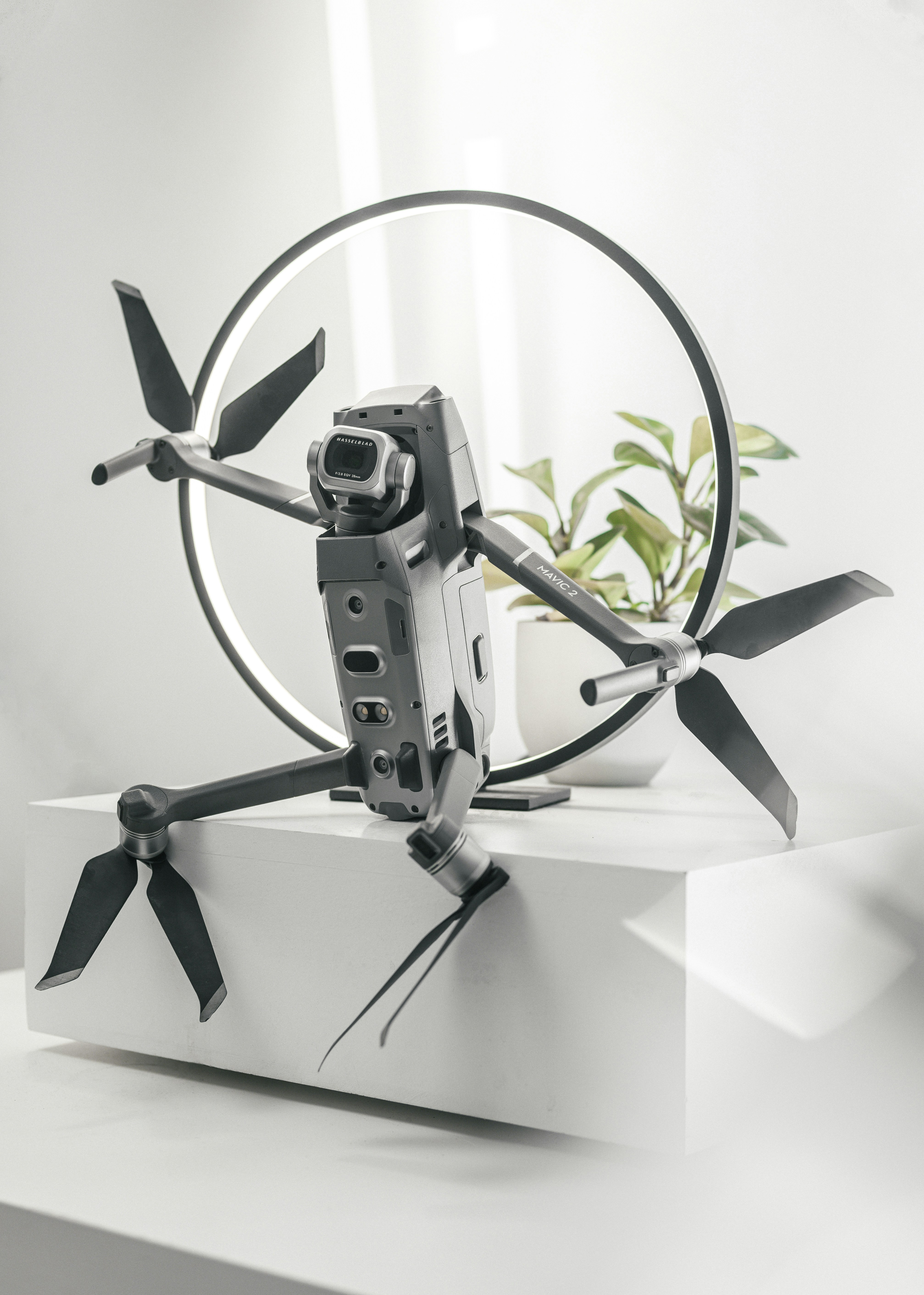
| DJI Mavic 2 Enterprise | 2018 | 1/2.3" CMOS | 12 MP | Electronic | Modular tools, but limited mapping use |
| DJI Mavic 3 Enterprise | 2022 | 4/3" CMOS | 20 MP | Mechanical | RTK, 56× zoom variant (Thermal) |
| DJI Zenmuse P1 (Matrice) | 2021 | Full-frame CMOS | 45 MP | Mechanical | High-accuracy photogrammetry |
With platforms like the Mavic 3E, we now routinely produce maps and terrain models with 1–2 cm GSD. At Parametrix, this has transformed how we support earthworks validation, topographic modelling, and cut/fill planning, all without relying heavily on ground surveyors.
Precision Through Positioning
In 2018, survey-grade positional accuracy typically required a Phantom 4 RTK, or laborious GCP placement.
Today, RTK and PPK (post-processed kinematic) are baseline expectations for any professional mapping drone. Even compact units like the M3E come equipped with:
- Multi-band GNSS receivers
- NTRIP compatibility
- Base station support for centimetre positioning
This level of precision enables automated georeferenced workflows at Parametrix. We often pair RTK flights with ISO 19650-compliant BIM processes, ensuring all drone data aligns with the project’s information management structure — from design to operations.
Obstacle Avoidance & Autonomy
Early drones avoided obstacles by guessing. Maybe they had forward sensors, sometimes down. But a rogue tree branch or scaffold pole? Game over.
The story in 2025 is very different. Modern drones, especially enterprise-class platforms, now feature:
- Omnidirectional vision systems
- AI-based path prediction
- Real-time 3D environment mapping
- Return-to-home logic with environmental awareness
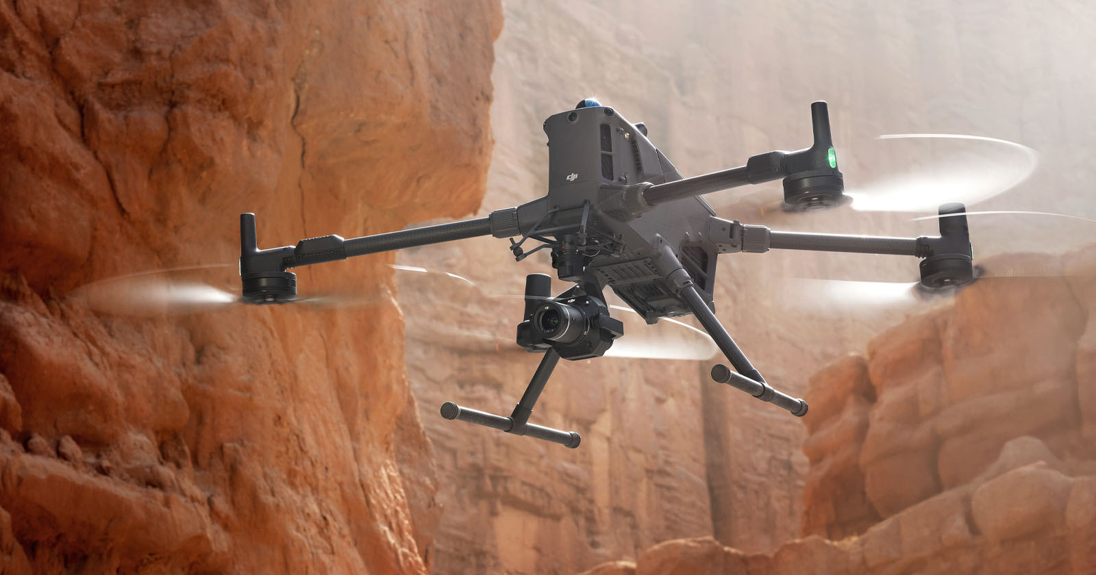
This autonomy isn’t just about avoiding crashes. It enables safer, closer inspections, and more confident navigation in confined or cluttered sites. On a recent Parametrix inspection project, for example, we flew Matrice 3E drone within inches of a Grade II-listed façade — capturing detail without risking damage or losing line of sight.
Integrated Payloads: Multi-Sensor, Multi-Mission
In 2018, swapping payloads required tools, firmware updates, or multiple drone bodies. Thermal imaging, for instance, was rudimentary, low-resolution, non-radiometric, and often more confusing than helpful.
By 2025, integrated payloads are the norm. A single flight can now yield:
- RGB imagery (for orthophotos and photogrammetry)
- Thermal imagery (for heat loss, solar faults, envelope diagnostics)
- Zoomed visuals (for façade condition surveys)
- Laser range finding (for structural profiling)
Example: DJI Matrice 4T Payload Suite
- 48 MP zoom camera (70 mm lens)
- 1280×1024 thermal imager (radiometric)
- Wide-angle mapping lens with mechanical shutter
- Integrated laser rangefinder
- Real-time image classification with AI inspection modes
At Parametrix, we use multi-sensor payloads to support multi-disciplinary deliverables. A single UAV mission can generate outputs for architectural modelling, structural condition reporting, and environmental performance assessment, dramatically improving efficiency.
From Foldable Toys to Serious Survey Tools
Once, compact drones were just convenient. Now they’re formidable.
The DJI Mavic 3E is a case in point: foldable, under 1kg, and yet capable of RTK-enabled mapping, mechanical shutter capture, and multi-day workflows.
Even sub-250g drones like the DJI Mini 4 Pro offer tri-directional obstacle avoidance, 48 MP imagery, and 34+ minute endurance. These are not your nephew’s Christmas toys. They’re urban survey tools, often deployed by Parametrix for internal courtyards, restricted access areas, and exploratory BIM projects.
And then there’s the DJI Flip, a 2024 release with integrated prop guards and a bump-resistant body. We use it in warehouses, plant rooms, or atriums where scaffolding would be expensive and disruptive.
Heavyweight Data Rigs
At the other end of the spectrum, DJI’s Matrice 300/350 RTK and Matrice 4E/T represent the flagship enterprise tier.
These systems support:
- Dual-operator modes
- Redundant batteries and sensors
- Weather resistance (IP55+)
- Triple payload capacity
We deploy Matrice units on our most demanding projects, large sites aiming for high-precision digital twins as this is where payload flexibility is essential to survey efficiency.
The Real Differentiators
The market is crowded. So how do we actually compare drones now?
Here's how we think about it at Parametrix:
| Factor | 2018 Standard | 2025 Expectation |
|---|
| Camera Resolution | 12 MP | 20–48 MP (mechanical shutter expected) |
| Positioning Accuracy | GNSS only | RTK/PPK with cm-level precision |
| Obstacle Avoidance | Front-facing sensors | Omnidirectional + AI predictive mapping |
| Thermal Imaging | 160×120 basic | 640–1280 resolution with radiometrics |
| Payload Modularity | Rare | Standard on all enterprise platforms |
| Flight Time | ~25 min | 40–55 min |
| Weather Resilience | Light rain = grounded | IP-rated, wind-tolerant |
| Autonomy | Waypoints | Real-time AI, auto-mapping, object detection |
Impressive improvements – right?
Skydio, Autel, and Fixed-Wing Disruptors (blue/gold heading)
While DJI remains dominant, the wider market has innovated aggressively.
- Skydio brought unmatched autonomy, drones that map and navigate dynamically in 3D space using 360° visual SLAM, ideal for confined inspections.
- Autel’s Evo II series pushed sensor specs with 8K RGB, thermal dual payloads, and non-geofenced operation, attractive in complex airspaces.
- WingtraOne and other fixed-wing UAVs gained ground in corridor mapping and large-scale agriculture, with vertical takeoff, 8 km range, and 2 cm GSD across hectares.
At Parametrix, we maintain awareness of all major platforms and test their capabilities internally to ensure technology is selected based on fitness-for-purpose, not brand allegiance.
What This Means for Our Methodology
Drone evolution hasn’t just changed what we fly, it’s reshaped how we work.
We now:
- Treat drone data as core project data, not a bolt-on
- Build digital twin workflows that begin with aerial capture
- Deliver outputs structured to ISO 19650, ensuring immediate integration into BIM environments
- Advise clients on drone specification, deployment strategy, and dataset interpretation
Our drone operations team isn’t siloed, it collaborates daily with our BIM, GIS, modelling, and asset management teams. This ensures that the data we collect is not only accurate but actionable.
Closing Thoughts: The View from 2025
Looking back to 2018, it’s hard to believe how far UAV technology has come. But looking forward it’s even harder to imagine slowing down.
With automated drone-in-a-box systems, real-time 3D mesh streaming, and AI-powered defect detection already on the horizon, drones are set to become even more embedded in the digital built environment.
At Parametrix, we’re not just flying into that future, we’re helping define it.
We know that when the sky becomes a data layer, every altitude is an opportunity.